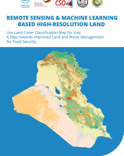
Breadcrumb Home / Resources / Publications / Remote Sensing & Machine Learning Based High-Resolution Land Publication Remote Sensing & Machine Learning Based High-Resolution Land 08 June 2024 Use Land Cover Classification Map for Iraq A Step towards Improved Land and Water Management for Food Security Published by WFP English File type: PDF Downloads: 607 Arabic File type: PDF Downloads: 663 Goals we are supporting through this initiative Related Resources Resources 02 May 2026 FAO-WFP Information note Resources 22 November 2025 UNAMI Herald - Volume 12, Issue 5 Resources 30 September 2025 UNAMI Herald - Volume 12, Issue 4